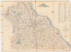
Aerial Photographs
Aerial Photographs, 1955, 1964, 1971 & 1982.
Description: Photographs taken of the entire county by air.
Content: Consists of photographs showing streets, highways, rivers, streams, structures and other physical features. May contain handwritten notes listing names of towns, boroughs, municipalities, roads, landowners, businesses and route numbers.
Select Area from County Map
 1970's County Mapclick to search
 1980's County Mapclick to search
Note:
 Click on the 1970's or 1980's county map shown above to view a full-size county map. You will then be able to select an area from the map to view that selected area's photograph and details.
Back to Records Available

